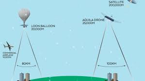
178. Google Earth uses high altitude planes not satellites

"People claim Google Earth somehow proves the ball model without realizing that Google Earth is simply a composite program of images taken from high-altitude planes and street-level car-cameras superimposed onto a CGI model of a ball Earth. The same could be just as easily modeled onto a square Earth or any other shape and therefore cannot be used as proof of Earth’s rotundity." Could be true But that does not prove it is true. Some evidence for the things Dubay claims would be nice occasionally. < Prev 171-180 Next >